Poor weekend, fun Monday
South Australian Forecast by Craig Brokensha (issued Friday October 20th)
Best Days: Monday both coasts
Features of the Forecast (tl;dr)
- Weak windswell tomorrow, easing with S/SE winds on the Mid, S/SW down South
- Small mid-period W/SW swell building Sun with E winds ahead of sea breezes
- Small-mod sized mid-period W/SW swell Mon with E/NE morning winds on the Mid, N/NE down South ahead of sea breezes
- Easing swell Tue with variable tending S/SW winds
Recap
Our peak in W/SW groundswell came in nicely yesterday with good 2ft+ sets across the Mid Coast on the favourable parts of the tide, while the South Coast was on the lower end of the scale and to 2-3ft across Middleton.
Conditions remained great all day as a low moved across us bringing some funky weather and varying winds, while today the change proper behind the the low is creating poor conditions.

Great waves yesterday
This weekend and next week (Oct 21 - 25)
The weekend looks generally poor with today’s low due to clear east and with it any localised windswell will start easing. The Mid Coast should see S/SE winds tomorrow morning with fading 1-1.5ft sets, onshore and poor down South with a moderate to fresh, but easing S/SW breeze.
Lighter winds are due on Sunday out of the E/SE (tending E/NE down South) but with tiny levels of swell across Middleton, while the Mid Coast should see some new, inconsistent W/SW swell building.
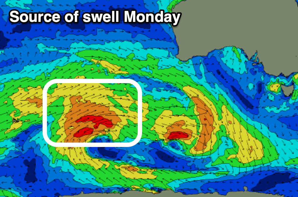
This swell and a stronger pulse for Monday are being generated by a broad, slow moving progression of frontal systems from the north of the Heard Island region and south-west of Western Australia.

The first pulse on Sunday looks to build to 1-1.5ft across the Mid through the day but with sea breezes.
The better swell for Monday has been generated by a good, persistent but distant fetch of strong to sub-gale-force W/SW winds to the south-west of Western Australia.
The Mid Coast should see better but inconsistent 1-2ft sets on Monday from this pulse with 2-3ft waves across Middleton.
Winds on Monday look favourable for both coasts with light, local offshore winds (E Mid and N/NE down South) ahead of sea breezes with Tuesday seeing early variable winds before a trough moves through, bringing a S/SW-S change.
This trough will spawn off a healthy mid-latitude front projecting up and under WA early next week, generating a fun pulse of W/SW swell Thursday/Friday with some S/SW later week as the trough forms into a low. More on this Friday. Have a great weekend!

