Few mucky days of onshore wind ahead but stacked forecast into next week

freeride76

Few mucky days of onshore wind ahead but stacked forecast into next week

freeride76

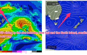
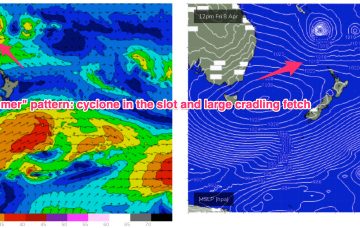
TC Fili is expected to track into the slot and stall- roughly equidistant between New Caledonia, the North Island and the East Coast of Australia. At some stage it will lose intensity and become extra-tropical but even as an ex TC the overall cradling fetch of E’ly winds is going to supply days of E’ly swell.

TC expected to drift into the Coral Sea with another extended round of E'ly swell ahead

freeride76

TC expected to drift into the Coral Sea with another extended round of E'ly swell ahead

freeride76

A depression just to the North-West of New Caledonia now has a high chance of forming a tropical cyclone (Fili) with this system expected to supply some pulses of swell from the NE to E quadrant as it tracks into the Coral Sea. A large cradling fetch of E to SE winds is also aimed at sub-tropical areas and should produce plenty of swell for the region this week.