Poor weekend, good run of westerly swell next week
South Australian Surf Forecast by Craig Brokensha (issued Friday December 1st)
Best Days: Depserate surfers Sunday morning South Coast, later Tuesday Mid Coast, Wednesday and Thursday both coasts (winds pending South Coast)
Features of the Forecast (tl;dr)
- Gusty S/SE-S winds tomorrow with a small weak S windswell
- E-E/NE tending S/SE winds Sun with a weak, small fading mix of swells
- Tiny Mon with N/NE-N/NW tending S/SE winds
- Moderate sized, inconsistent W/SW groundswell building Tue, holding Wed, with a reinforcing mid-period pulse Thu, easing Fri
- Variable tending SW winds on the Mid Tue, S down South
- E tending S/SE winds on Wed and Thu
- Possible SW change Fri
Recap
Winds have been slowly easing across the South Coast but remaining onshore along with poor levels of weak, easing windswell.
The Mid Coast has been near flat with nothing to surf.
This weekend and next week (Dec 2 - 8)
The current weakening pattern of wind and windswell is thanks to the inland low that drifted south-east and into the Tasman Sea mid-week, now weakening and starting to push off further to the east. This will see winds remain fresh out of the S’th tomorrow, improving on Sunday and becoming lighter E/NE-E in the morning.
Unfortunately the blocking effects of high pressure sitting across the Southern Ocean means there’s no decent swell due, with easing levels of windswell tomorrow, and some very inconsistent, mid-period background swell on Sunday.
We’re talking 1-2ft sets mix across Middleton, with nothing in the Mid Coast.
Our offshore N/NE-N/NW breeze is still expected on Monday but the surf will be bottoming out, tiny and unsurfable for most.
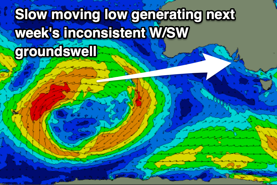
Moving into Tuesday we’re expected to see our fun, moderate sized W/SW groundswell filling in, generated by a slow moving low pressure system currently pushing through the southern Indian Ocean.
A fetch of strong to at times gale-force W/SW winds are being generated through our western swell window, with the low due to stall and break down but persist to the south-west of Western Australia this weekend and early next week.

This will result in a persistent run of W/SW groundswell and mid-period energy from Tuesday through the end of the week, with the first pulse on Tuesday being the least consistent.
We should see the Mid Coast building to 2ft+ through the afternoon/evening with surf holding 2ft on Wednesday, still holding a fun 2ft on the favourable parts of the tide on Thursday.
The South Coast won’t see much size owing to the westerly angle of the swell, coming in at 2-3ft across Middleton later Tuesday, holding Wednesday and then easing slowly Thursday.
Local winds on Tuesday will be variable early though shifting onshore across both coasts mid-late morning as a trough slides through.
The trough may form a small low pressure centre on Wednesday and linger in the area, bringing E’ly morning winds across the South Coast, E/SE-SE on the Mid before reverting back to the S/SE, and then similar Thursday.
Longer term the outlook is a little wishy-washy but more on this Monday. Have a great weekend!

