Average surf until late week
South Australian Surf Forecast by Craig Brokensha (issued Monday August 2nd)
Best Days: Friday through Monday on the South Coast
Features of the Forecast (tl;dr)
- New mid-period W/SW swell for tomorrow but with strong SW winds (possibly W at times early down South)
- Weak W/SW swell also building across the South Coast into the PM
- Easing mix of weak swells Wed with fresh W/SW winds (W/NW for a period early down South)
- Building SW groundswell late Thu with W/NW tending SW winds, peaking Fri AM with W/NW tending W winds
- Stronger SW groundswell Sat with NW tending variable winds (NE tending NW on the Mid)
- Easing SW groundswell Sun and Mon with N winds
Recap
A low point in swell Saturday across the South Coast, best on the swell magnets with lumpy 1-2ft waves on the Mid Coast for the keen. A new W'ly swell built into the afternoon on the Mid and also down South, with Sunday seeing really fun 3ft surf across the Mid with workable winds all day, fun and to 3ft across the South Coast.
Today the swell has eased back in size with onshore winds on the Mid, smaller down South with strengthening winds from the northern quarter.
This week and weekend (Aug 3 - 8)
The coming couple of days aren't too special but from late Thursday and more so Friday, into the weekend we've got some good pulses of SW groundswell on the cards with favourable winds for the South Coast.
An approaching change linked to a weakening mid-latitude low moving across us will bring strong SW winds tomorrow that may tend W'ly early around Victor, but with no real quality swell in the water it's a moot point.
The change looks to bring a poor, weak afternoon increase in SW swell to 2-3ft across Middleton into the afternoon, while the Mid Coast looks to come in at 2ft to possibly 3ft as a new mid-period swell from the earlier stages of the low moves in, but with choppy conditions.
The swell will ease into Wednesday and as fresh W/SW winds persist, tending W/NW for a period down South but with easing surf from a weak 2ft+ or so, it's again not worth worrying about. The Mid looks to ease from 2ft on the sets but remain bumpy.
A low point is due into Thursday morning with W/NW winds across the South Coast, possibly variable for a period early on the Mid but tiny. The afternoon will see bumpy conditions with a SW breeze and later into the day, we've got a new pulse of SW groundswell due.
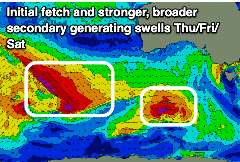
 This swell will be generated by the first in a flurry of pre-frontal fetches of W/NW gales moving south-east from the Indian Ocean, with a late increase to 3ft due across Middleton, tiny and to 1-1.5ft on the Mid Coast.
The swell looks to peak Friday morning 3ft to possibly 4ft across Middleton down South, easing a touch through the day under W/NW tending W winds down South.
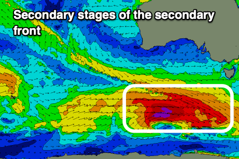
Into Saturday we've got a stronger and bigger pulse of SW groundswell due, generated by stronger pre-frontal W/NW winds sliding in from the Indian Ocean before a polar low forms, aiming severe-gale W'ly winds through our south-western swell window on the polar shelf.
 This swell should provide stronger 4-5ft+ sets across Middleton, with the direction seeing 1-1.5ft sets persisting on the Mid Coast under NW tending variable winds down South, NE tending NW on the Mid.
The swell will ease Sunday under great N'ly winds opening up plenty of options down South, smaller Monday as N winds persist.
Longer term we may see a tricky small pulse of W swell on the Mid Monday afternoon, but otherwise a strong polar frontal progression firing up towards Western Australia on the weekend looks to generate a moderate sized W/SW groundswell for us late week. More on this in the coming updates.

