Good swells hindered by onshore winds
South Australian Surf Forecast by Craig Brokensha (issued Wednesday January 13th)
Best Days: Desperate surfers on the Mid Friday, early Saturday on the Mid
Features of the Forecast (tl;dr)
- Good SW-W/SW swell Friday but with strong SW tending S/SW winds, easing Sat with early S/SE winds on the Mid
- Fun new S/SW swell for Mon AM but with S/SE winds
Recap
Poor conditions with the onshore wind and small swell down South yesterday morning, though we saw a nice kick in energy through the afternoon, while the Mid Coast also improved with tiny, windswelly 0.5-1ft waves in the morning building to a stronger 1-1.5ft through the afternoon.
Today we've got similar sized waves on the Mid, masked by the early, large morning tide while the South Coast is really fun with clean conditions and 2-3ft sets across Middleton. I hope you made the most of the conditions as a trough is now moving through, bringing an onshore change.

Early this AM, pity about the tide
This week and weekend (Jan 14 - 17)
Tomorrow looks like a lay day with onshore SW tending S/SW winds on the South Coast with a drop in swell from this afternoon, dropping back from 2ft to possibly 3ft across Middleton, while the Mid should see an early S/SE breeze but tiny, full 1-1.5ft of swell, hindered by the big morning high tide again.
Of greater importance is the new SW groundswell due Friday, with the added W/SW component for the Mid Coast, but unfortunately winds now look onshore for the gulf.
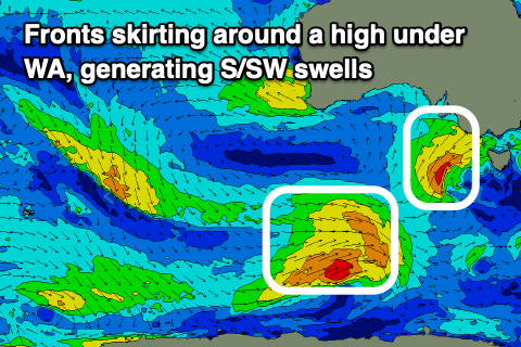
The groundswell was generated by a healthy polar low firing up east of the Heard Island region earlier this week, weakening yesterday while moving more through our western swell window.
 Size wise the Mid Coast should see 1-2ft waves on Friday with the South Coast coming in around 3ft+ through the morning. Unfortunately, as touched on above we'll see a weak low projecting SW winds up and into us tomorrow and Friday, generating an additional S/SW swell for later in the day (3-4ft Middleton) but more so Saturday morning, though more importantly, strong SW tending S/SW winds. This will create poor conditions and add some additional windswell to the mix on the Mid.
S/SW winds will persist across the South Coast Saturday as the S/SW swell eases back from 3ft to possibly 4ft across Middleton, 1-2ft on the Mid Coast. Winds are likely to tend S/SE across the Mid Coast Saturday morning, S/SW through the afternoon.
A secondary polar front will project a fetch of strong to near gale-force SW winds through our southern swell window on the back of the weak low, producing a new S/SW swell for Monday with good sets to 3-4ft due across Middleton. With the southerly direction the Mid is due to become tiny, and winds will be poor for the South Coast with S/SE winds Sunday due to persist Monday as a large, slow moving high edges in from the west.
This high will dominate our swell window through next week, with weak troughy weather to follow the week after, which doesn't bode well for swell generation. More on this Friday.


Comments
it seems judging by the cams the beginners have found triggs, plenty out there and noted on southport cam, beach was pretty empty, such is life
Multiple recent sharks
I've heard about recent shark encounters on the mid. Bronzies or whites? I was out at Rincon Tuesday arvo. We had a dolphin pop up right in front of us. Kinda scared the $#!+ out of the line up as we where just discussing the local shark sighting. Lol
Lol good call, im sure Ben Cousins would agree
Great forecast as usual Swellnet, but hopefully the gods can give us winds with a N in it not SE :)