Large prolonged W/SW swell event from Sunday
South Australian Forecast by Craig Brokensha (issued Friday 3rd August)
Best Days: Keen surfers South Coast tomorrow, South Coast Sunday and Monday morning, Tuesday through the end of the week
Recap
Wednesday's swell dropped right back through yesterday with slower and bumpy 2-3ft waves off Middleton, cleaner but tiny into the afternoon, while the Mid Coast's strong swell was back to a tiny and bumpy 1-1.5ft.
A vigorous front pushed across us overnight and early this morning bringing heavy rainfalls but no real change to the swell situation. The South Coast was clean but tiny and the Mid Coast poor with a tiny choppy windswell.
Later today we should see some new W/SW groundswell building across both coasts, though sets to a very slow 2ft are due off Middleton with 2ft of windswell on the Mid Coast as winds persist from the W/NW.
Today’s Forecaster Notes are brought to you by Rip Curl
This weekend and next week (Aug 4 - 10)
Want to receive an email when these Forecaster Notes are updated? Then log in here and update your preferences.
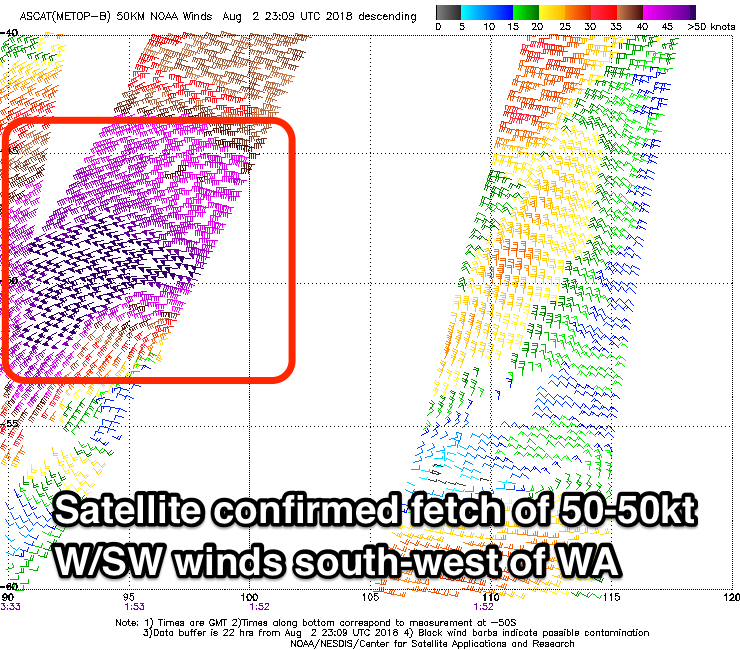
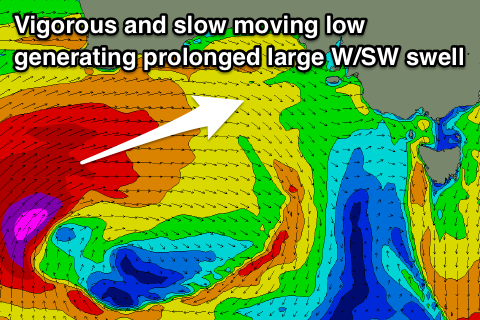
 Currently a severe-low that developed south-west of WA is projecting a fetch of storm-force W/SW winds slowly east-northeast towards us.
Satellite observations have already confirmed a fetch of storm-force (50-55kt) winds in our swell window, and the continued track of the low towards us today will generate a large long-period W/SW groundswell for Sunday, peaking through the afternoon.
We'll see this low stall under WA this evening and tomorrow, while weakening slightly though continuing to generate a fetch of gale to severe-gale W'ly winds in our western swell window.
The low will then slowly push east through the Bight on Sunday as wind strengths drop back to below gale-force, with it moving across us through Monday.
What will result is a prolonged W/SW groundswell event, largest and strongest Sunday afternoon but still large Monday, tailing off slowly Tuesday.
Coming back to tomorrow though before all large stuff hits, we've got some less consistent and smaller W/SW groundswell due, generated by tricky and less than favourably aligned storms in the south-east Indian Ocean this week.
 The Mid Coast looks to come in at 1-2ft, with 2ft of NW windswell building later in the day under strengthening N/NW winds.
The South Coast will be clean, but the models are over-forecasting the expected size with a slow 2ft+ wave due off Middleton, possibly more 3ft towards Cliffs and Goolwa.
Sunday will see the Mid Coast kicking to a solid 3-4ft through the day, with Middleton building to 4-6ft into the afternoon under gusty NW tending W/NW winds.
This will favour the South Coast most of the day while creating poor conditions on the Mid Coast.
Into Monday we're likely to see the South Coast drop back a little as the swell swings more west, with easing 3-5ft sets off Middleton, while the Mid Coast should persist at a strong 3ft to occasionally 4ft on the favourable parts of the tide.
Winds will persist from the W/NW, favouring protected spots across the South Coast, with a late W/SW change on the cards.
Tuesday looks a bit smaller again, with easing sets from 3-4ft off Middleton and a drop back in size to 3ft on the Mid Coast as winds veer back to the W/NW-NW with another approaching mid-latitude front.
Looking at the outlook for the rest of the week and we'll continue to see mid-latitude fronts pushing across the country and through our western swell window.
These fronts won't have the structure or consolidation of the current low resulting in mid-period swells for our region, but the Mid Coast will continue to see plenty of swell though with onshore winds. The South Coast looks smaller but fun, though we'll have a look at this in more detail on Monday.
Have a great weekend!


Comments
Already starting to trend upwards at Victor.. how's these lines of groundswell at Middleton!


Ha, that's probably me on the right there Ben, out the back having all my expectations dashed. Why do I still bother paddling out at Middleton?