Average end to the week, good W/SW swells next week
South Australian Forecast by Craig Brokensha (issued Wednesday 4th October)
Best Days: Saturday morning South Coast, Sunday morning swell magnets South Coast, protected spots South Coast Monday morning, both coasts Monday
Recap
Pumping surf down South with a solid SW groundswell to 4-5ft off Middleton during the morning and 1-1.5ft+ on the Mid with offshore winds. The swell eased off a touch into the afternoon with weak sea breeze, while today we've got a bit less size again though with great winds for swell magnets down South.
This week and weekend (Oct 5 - 8)
Currently a surface trough is moving in from the west, deepening slightly as it continues east across us early tomorrow morning.
We'll see winds swinging strong onshore out of the S/SW by mid-morning, but at dawn there may still be more favourable W/NW winds around Victor. Middleton looks to be easing from 2-3ft and after our recent run of surf, it's not worth a drive from Victor.
This trough will generate an increase in S/SW windswell through the day, easing back through Friday from a messy 3ft+ with lingering SE winds. The Mid Coast is due to become tiny tomorrow and near flat Friday.
Into the weekend we'll see a small mix of fading S'ly windswell and new SW groundswell down South, generated by a thin but elongated fetch of pre-frontal W/NW gales through our swell window over the coming days.
Middleton should see 2ft to occasionally 3ft sets during the morning, easing back into the afternoon and smaller Sunday morning. Fresh NE-N/NE winds will favour Goolwa, Waits and Parsons more so than Middleton, while straighter offshore N/NW winds are expected Sunday morning, giving into a shallow W/SW change.
 The surf should be around 2ft off Middleton down South Sunday morning, with 0.5-1ft sets on the Mid Coast.
Of greater importance is some good new W/SW swells due into early next week.
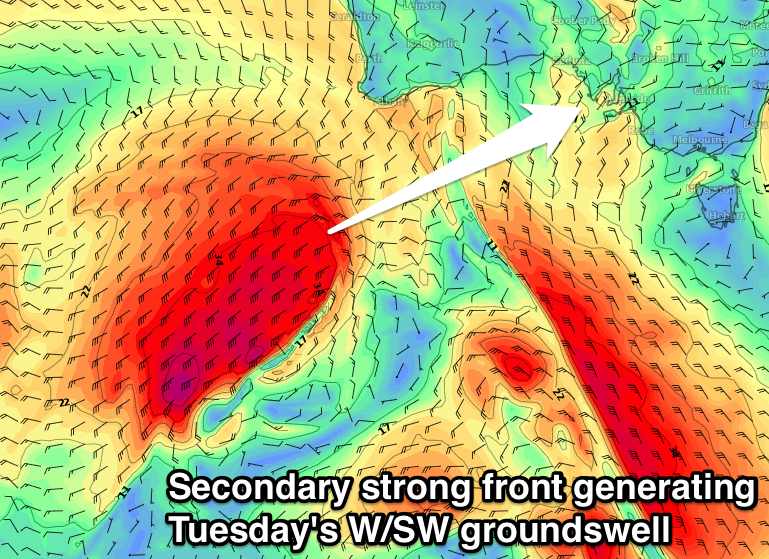
Back to back polar fronts are expected to project north-east towards WA over the coming days, with the first weakening while approaching WA Friday evening, while the second will maintain its strength right before pushing towards the Bight.
This will generate two separate W/SW groundswells, the first for Monday and building into the afternoon and reaching 2ft on the Mid Coast, with inconsistent 2-3ft sets across Middleton.
A much better and larger W/SW groundswell is then due Tuesday with strong sets to 3ft on the Mid Coast and 4ft sets off Middleton. Winds are looking great for both coasts on Tuesday as a high moves in behind the front passing through Monday resulting in local offshores before sea breezes kick in.
Have a check Friday for another look at this swell event.

