Lots of swell and wind to come this week
South Australian Forecast by Craig Brokensha (issued Monday 14th August)
Best Days: South Coast tomorrow morning, then protected spots Wednesday through Friday morning, South Coast Sunday morning
Recap
A drop in swell from Friday across the Mid Coast with easing 2ft+ sets under N/NW winds. Sunday was back to 1-1.5ft but bumpy again.
The South Coast offered the best waves with great clean 3-5ft surf off Middleton Saturday morning, back to 2-3ft yesterday as stronger offshore winds created tricky conditions.
Today the surf was tiny across both coasts, best at Waits and Parsons down South.
This week and weekend (Aug 15- 20)
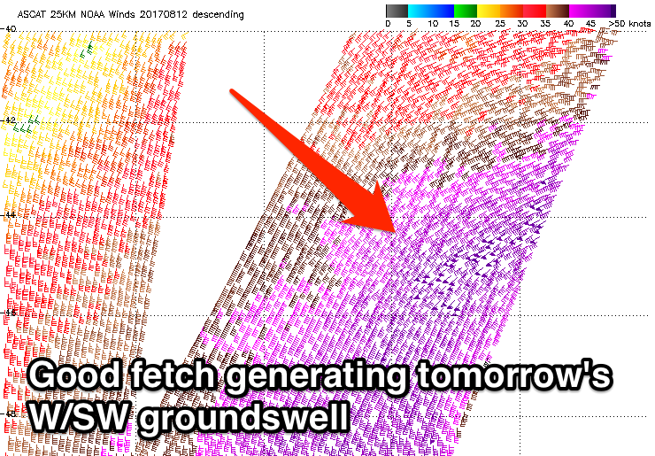
We've got lots of westerly swell due this week, the first pulse for tomorrow being generated over the weekend by a great fetch of severe-gale to storm-force W/SW winds south-west of WA.
 The W/SW groundswell should fill in tomorrow, with 1-2ft sets on the Mid Coast, while Middleton should see 2-3ft waves. A moderate to fresh N/NW wind will shift W/NW through the day, favouring the South Coast, while the Mid Coast will be bumpy and deteriorate.
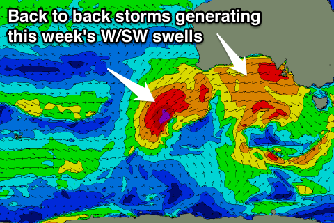
This shift in wind will be related to the mid-latitude system off WA pushing east, with a great fetch of strong to gale-force W'ly winds being projected through the Bight tomorrow, followed by a secondary slightly stronger push Wednesday and Thursday.
What we'll see is a moderate sized W/SW groundswell building through Wednesday, mixed in with a windswell on the Mid Coast. Messy 3ft waves are due with fresh W/NW winds, while the South Coast should see building surf to 3-4ft and W/NW tending NW winds will create good conditions in protected spots.
The secondary stronger front will produce a larger W/SW groundswell for Friday, but ahead of this we'll see stormy W/SW windswell as the front races ahead of the swell its producing.
The Mid Coast is expected to build to a stormy 4ft through the day Thursday, with the South Coast dropping back temporarily to the 3ft+ range with the west in the swell along with strong W/NW winds.
 Come Friday the groundswell should keep the Mid Coast kicking at 3-4ft all day, with a slight kick in size back to the 4ft range across Middleton.
A fresh W/SW breeze will keep conditions average on the Mid Coast, while the Victor region should see a morning W/NW'ly, favouring protected spots.
Into the weekend the W/SW swell will ease, but a reinforcing S'ly swell is due to fill in down South, produced by a great fetch of strong to gale-force S/SW winds projecting up towards us on the backside of the storm moving through this week.
4ft sets should persist off Middleton Saturday morning, easing slowly through the day and further from 3ft Sunday morning. The Mid Coast will drop back to the smaller 2-3ft range, fading from 1-1.5ft Sunday.
Onshore winds look likely across both coasts on Saturday in the wake of Friday's change, with better N'ly winds on Sunday. We'll have a closer look at this Wednesday though.

