Easing surf with improving winds, great Friday
South Australian Forecast (issued Monday 28th March)
Best Days: Every morning this week down South, pumping Friday, Mid Coast later Saturday and Sunday
Recap
Tiny clean set waves around the 1-1.5ft range most of the weekend on the Mid, while the South Coast was best Saturday morning with a fun clean SW groundswell to 3-4ft under a light W'ly wind.
Through Sunday a strong and powerful S/SW groundswell filled in offering large 6ft sets across most exposed breaks, and variable winds created decent conditions before a fresh S/SE'ly kicked in mid-morning.
Today the swell has eased back a bit, but there's still plenty of size across the coast in the 4ft range with light E/NE winds. The Mid Coast has continued around 1-1.5ft with straight offshore winds.
This week (Mar 29 – Apr 1)
South Coast: Moderate amounts of reinforcing S/SW groundswell are due this afternoon and tomorrow before easing into the afternoon and further Wednesday. The source of this swell is an elongated and broad fetch of strong SW winds on the backside of the strong and powerful low responsible for yesterday's S/SW groundswell.
Middleton should persist around 3ft+ tomorrow with 4-5ft sets at Waits and Parsons, easing back from 3ft and 4ft respectively Wednesday morning.
Conditions tomorrow will be similar to today with an E'ly breeze due through the morning ahead of S/SE sea breezes.
Wednesday is looking better with a light variable wind through the morning, tending SW through the day.
 A low point in swell activity is due Thursday morning with offshore NW winds, favouring Waits and Parsons where there should still be fun 3ft+ sets.
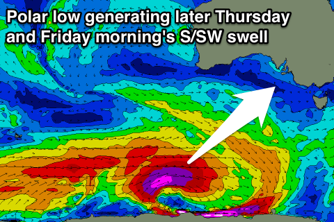
Later in the day and more so Friday, a strong long-period S/SW groundswell is due, generated by an intense polar low forming south-west of WA this evening. This low will generate a fetch of severe-gale to storm-force W/SW winds through our south-western swell window.
The swell may be seen late Thursday ahead of a peak Friday morning to an inconsistent 3-5ft at Middleton with 4-6ft sets at Waits and Parsons. Conditions are looking great all day with a N/NW offshore, favouring most locations.
Mid Coast: Today's swell will fade back from the 1ft range tomorrow and become even tinier Wednesday before bottoming out Thursday.
The S/SW groundswell for Friday isn't too favourable at all, with 0.5-1ft sets max due through the day.
This weekend onwards (Apr 2 onwards)
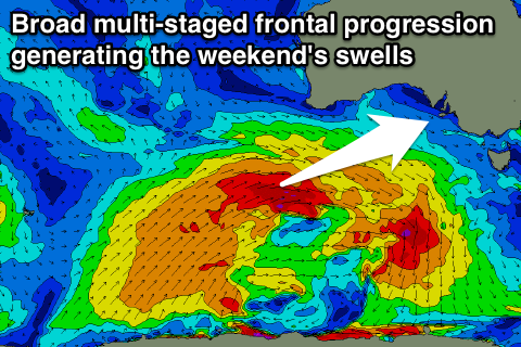
 Friday's S/SW groundswell will just be the beginning of a much broader and multi-staged frontal progression under the country through the middle to end of the week, all due to a strong node of the Long Wave Trough moving slowly east.
On the back of the polar low, a fetch of severe-gale W/SW winds will be generated, before being piggy-backed by two successive and broad frontal systems, projecting SW gales up towards and through the Bight.
What this will result in is a mix of SW and W/SW swells for the weekend, building through Saturday and peaking Sunday somewhere in the 4-6ft range at Middleton, 6-8ft at Waits and Parsons and 2-3ft on the Mid Coast, with what looks to be E/SE winds. More on this Wednesday though.

