Ments: Fun into the weekend, large and powerful Monday
Nias, Mentawai, South Sumatra forecast by Craig Brokensha (issued Thu 7th Aug)
Best Days: Every day over the coming period
This week and next week (Aug 8 - 15)
A reinforcing S/SW groundswell would of filled in today across the region offering inconsistent 6-8ft sets at exposed spots with light to moderate winds from the W/NW around the Ments and Nias with more variable winds along Southern Sumatra.
A gradual drop in size is due from later today through tomorrow and Saturday before bottoming out on Sunday morning. Winds should improve across all regions though with weak E/SE trades tomorrow, becoming a touch stronger Saturday and Sunday (more so in South Sumatra).
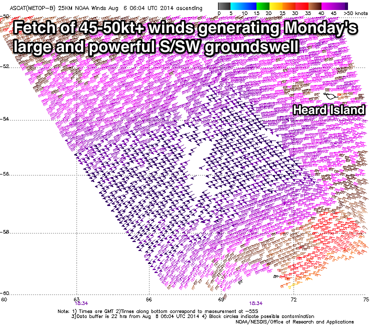
 Now, Monday's large and powerful S/SW groundswell is tracking along really nicely with satellite observations (right) confirming a broad fetch of severe-gale to storm-force W/SW winds in the Heard Island region. This was at the strongest stage of the polar frontal progression generating the swell, and we should continue to see a fetch of severe-gale W/SW winds produced through our swell window today and tomorrow before the system starts moving out of our swell window, under Australia Friday.
The fore-runners of this groundswell should arrive late in the day Sunday but Monday morning will reveal the peak of the swell with large 8-10ft waves in the Ments, 8ft+ around Nias and 10ft+ in South Sumatra.
Fresh E/SE tending SE trades are expected around South Sumatra during the peak Monday while moderate SE winds are due further north.
A drop in swell should be seen later Monday with a steady easing trend seen through Tuesday and Wednesday with generally light variable winds.
Beyond this we'll see inconsistent levels of medium to large S/SW groundswell through the end of the week and weekend, but we'll discuss this in more detail on Tuesday.
16 day Mentawai forecast graph
16 day Nias forecast graph
16 day South Sumatra forecast graph

