Small to tiny outlook
Eastern Tasmania Surf Forecast by Craig Brokensha (issued Monday 29th March)
Best Days: South swell magnets tomorrow morning
Features of the Forecast (tl;dr)
- Weak, fading S'ly swell tomorrow with W/SW tending NE winds
- Flukey S groundswell for Mon with morning offshores
Recap
Small, bumpy waves Saturday for the keen, cleaner Sunday but slow and back to 1-2ft for the patient. Today is gorgeous but with no swell.
This week and weekend (Mar 30 – Apr 4)
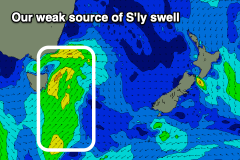
 A cold front pushing up past us today should be bringing an increase in S'ly swell across the region, with it peaking overnight and easing back from 2ft to near 3ft on the south magnets tomorrow morning.
Conditions will be best in the morning with a light W/SW offshore, giving into NE sea breezes.
This might be worth making the most of, as there's nothing too significant to follow until Monday week, and that'll be a poorly aligned S'ly groundswell.
The source of this swell will be a strong frontal progression passing under us Saturday, with a possible small, inconsistent 2ft set due on the south magnets Monday.
Winds look favourable at this stage and offshore in the morning but we'll have to confirm this and the swell in the coming updates.
Longer term, tropical activity in the Coral Sea looks to stay too far north to influence us most of next week, but there may be better developments later next week. More on this in the Wednesday and Friday.


Comments
And here we have a shiny new directional wave buoy sitting east of Maria Island and south of Freycinet..
http://www.bom.gov.au/products/IDT65091.shtml
Here's the location.