Fading E/NE swell
Eastern Tasmanian Surf Forecast by Craig Brokensha (issued Friday 9th October)
Best Days: Tomorrow
Recap
Wet, stormy and onshore surf developing through yesterday, large into the afternoon as a strong low moved down, adjacent the coast.
This low has continued drifting south-east today, resulting in a drop in swell but improving conditions with easing sets out of the E/NE.
This weekend and next week (Oct 10 - 16)
The current swell from the low drifting south-east across the state will continue to ease through tomorrow, fading Sunday.
An infeed of E/NE winds into the eastern flank of the low, to our east should keep less consistent 3-4ft sets hitting the swell magnets tomorrow morning, easing into the afternoon and dropping further from 1-2ft Sunday.
 Conditions will be good with local offshore winds tomorrow morning, variable into the afternoon and then W/SW tending NE winds Sunday.
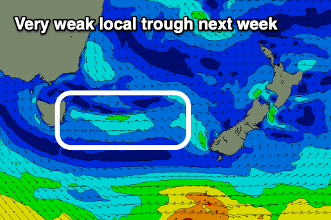
Following this there’s nothing significant on the cards for next week, with distant E/NE winds north-east of New Zealand possibly keeping very inconsistent 1-2ft waves hitting open beaches through early-mid next week, fading after. A local trough may also add to this swell early-mid next week but not push above 1-2ft.
Winds look N/NW tending N/NE on Monday, with a S’ly change Tuesday, possibly lingering onshore E/NE into Wednesday.
Longer term we may see a strong cold outbreak and S’ly swell late week/next weekend, but we’ll have a closer look at this on Monday. Have a great weekend!

