Small swells ahead of a large, stormy number
Eastern Tasmania Surf Forecast by Craig Brokensha (issued Monday 5th October)
Best Days: South swell magnets late tomorrow and early Wednesday, northern corners Thursday and Friday for experienced surfers
Recap
Poor surf on Saturday and Sunday with a small, weak N/NE windswell to 1-2ft max. Today there's a bit more size to 2-3ft out of the N/NE with southerly winds and clean conditions in southern corners.
This week and weekend (Oct 6 - 11)
Today's N/NE windswell will drop back to 1-2ft or so tomorrow, but a new S'ly swell should be on the build later, generated by a strong polar frontal progression that moved into our swell window yesterday. A good fetch of strong to gale-force W/SW winds should produce a good kick in size to 2-3ft across south swell magnets into the late afternoon, easing from a similar size Wednesday morning.
Winds tomorrow morning won't be ideal for these locations but there should be that 1-2ft of leftover N/NE windswell and a SW'ly, shifting SE and then NE into the afternoon.
Wednesday looks a bit cleaner with a variable wind in the morning ahead of E/NE sea breezes.
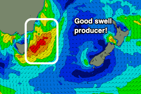
We then look to the deepening surface trough come low that's forecast to drift in slowly from the west later week. As the low does so, it'll squeeze a strong high in the Tasman Sea, with a fetch of strong to gale-force NE winds forming right off our region.
 The stationary nature of the fetch will produce a large increase in stormy NE swell through Thursday, reaching what looks to be an easy 8ft through the day with strong E/NE-NE winds.
As the low dips south-east we should see winds swing W/NW on Friday along with a rapid drop in NE tending E/NE energy, down from 5-6ft or so, back to 3-4ft into the afternoon.
The weekend looks smaller with 1-2ft leftovers and offshore westerly winds.
Longer term there's nothing significant on the cards, so try and make the most of the coming swell.

