Extended run of south to south-east swell
Eastern Tasmania Surf Forecast by Craig Brokensha (issued Friday 25th September)
Best Days: Sunday onwards
Recap
A small pulse of new S/SE swell yesterday with good winds through the day, still fun today and on the ease.
This weekend and next week (Sep 26 – Oct 2)
We've got a great and extended run of swell out of the south this period.
Today's swell will be gone tomorrow but we'll have fresh energy on the build out of the south as a broad though not overly strong polar front pushes up and into the Tasman Sea from below us.
 A fetch of strong S/SW winds will develop and push up past us tomorrow afternoon and evening, but with no major size from this due until Sunday where we should see 4ft waves across the south swell magnets, much smaller in other spots.
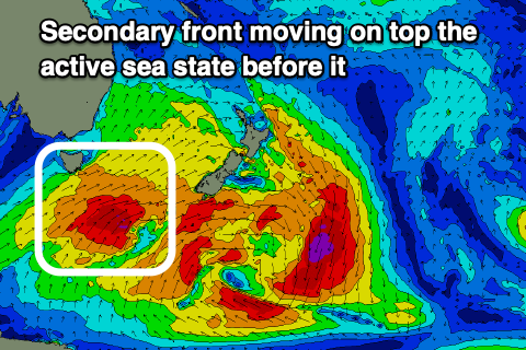
The swell may ease temporarily into the afternoon, but a secondary stronger polar front generating gales on the back of the initial front should generate a reinforcing pulse of S'ly groundswell for Monday.
Sets to 4ft are due into the afternoon, possibly more 3-4ft in the morning, then easing Tuesday from a similar 4ft.
Conditions will be generally favourable through this time with W/SW tending variable winds Sunday, and then W/SW tending NE on Monday, W/NW tending N/NE winds on Tuesday.
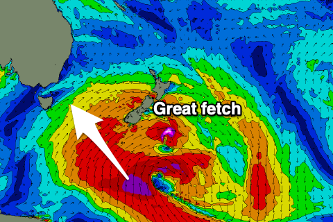
Moving into Wednesday and a strong pulse of S/SE groundswell is due, generated by the remnants of the weekends frontal activity forming into a broad, significant and stalling low south of New Zealand Monday.
 This will aim a fetch of gale to severe-gale winds in our south-eastern swell window, with, strong and powerful sets arriving Wednesday morning and peaking into the afternoon, holding Thursday morning before easing slowly.
We should see strong 5-6ft sets across the coast later in the day Wednesday, easing from 4-6ft on Thursday along with great N/NW breezes on the former, W/NW on the latter.
Beyond this it's too far our to see, but check back here on Monday for the latest. Have a great weekend!

