Upgrades all around
Eastern Tasmania Surf Forecast by Craig Brokensha (issued Wednesday 16th September)
Best Days: Saturday south swell magnets, Sunday, Monday and Tuesday
Recap
A small, building S'ly groundswell into yesterday afternoon and cleanest in northern corners, fading from a small 1-2ft today.
This week and weekend (Sep 17 - 20)
Tomorrow's a lay day with a trough bringing poor and strong S/SW tending S/SE winds along with a localised increase in small S'ly windswell.
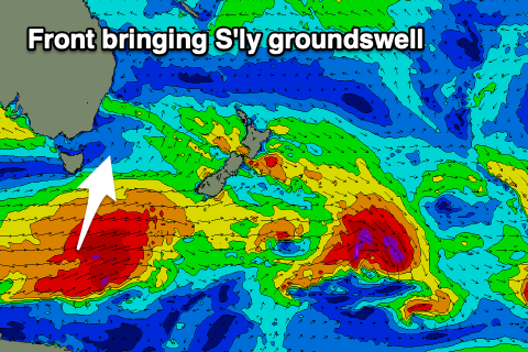
Of greater importance is an upgrade in the S'ly groundswell due Saturday, with it poosibly showing late Friday.
 The polar fetch of W'ly gales linked to this now look a touch stronger and will hold steam while passing under us Thursday evening.
The S'ly groundswell should peak Saturday morning and offer good 3ft to occasionally 4ft sets across the south swell magnets along with N/NW tending stronger NE winds.
The S'ly energy will fade Sunday from 2ft or so, but a building N/NE windswell event will be much more noticeable.
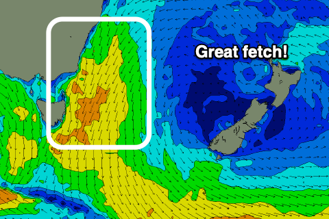
The N/NE swell will build Saturday and become quite decent in size Sunday and Monday as a broad mid-latitude low moving in from the Bight squeezes a strong high in the Tasman Sea.
 Strengthening and broadening N/NE winds will develop with building surf to 2-3ft across north facing beaches Saturday afternoon, building further Sunday to 4-5ft or so but with strengthening N tending N/NE winds.
It looks like we'll see a change try to edge in on Monday, swinging winds N/NW along with a drop in size from 4-5ft, dropping further from 2-3ft Tuesday as stronger W/NW winds move in.
We'll have to review the timing/sizes and local winds for this swell event on Friday though.

