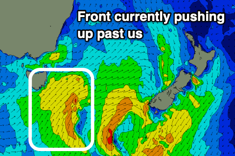
Very mediocre outlook after the recent run
Eastern Tasmania Surf Forecast by Craig Brokensha (issued Friday 21st February)
Best Days: No great days
Recap
Solid and easing sets out of the E/SE and SE yesterday, cleanest in southern corners, dropping back from a still chunky 3-4ft today, a bit bigger than expected.
This week and weekend (Feb 22 - 28)
Our current mix of swells are expected to fade into tomorrow leaving no real quality surfing options into the weekend.
A cold front that's currently pushing up and past out coast today is generating a weak S'ly windswell that is due to ease back through tomorrow, dropping from a weak 2ft at south swell magnets tomorrow, tiny into Sunday.
 If you're desperate for a surf hit those south swell magnets early with a light offshore wind due before sea breezes kick in.
The small and weak N/NE windswell mentioned in Wednesday's notes for Monday is still on track, but again we're looking at only 1-2ft sets max across north-east swell magnets and with no power.
Winds will be favourable early with a S'ly change, swinging more E later morning.
Longer term, unfortunately there's still nothing major on the cards as a strong node of the Long Wave Trough moves in across us, bringing lots of polar frontal activity but too zonal in nature to generate any S'ly swell. More on this Monday though. Have a great weekend!

