Fading north-east swell and flukey south swell
Eastern Tasmania Surf Forecast by Craig Brokensha (issued Wednesday 6th March)
Best Days: Thursday morning, south magnets early Saturday
Recap
A mix of inconsistent E/NE groundswell and NE trade-swell across the coast the last two days ebbing and pulsing between 2-3ft.
Today’s Forecaster Notes are brought to you by Rip Curl
This week and weekend (Mar 7 - 10)
The E/NE groundswell signal from Tropical Cyclone Pola should be gone, and our small NE trade-swell event is expected to start fading tomorrow, dropping from a small 2ft across open beaches. Conditions should be clean most of the day with a W/NW tending N/NW breeze.
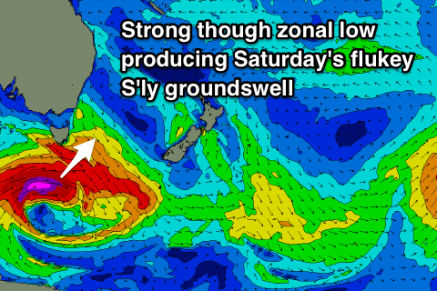
 The only other source of swell this weekend will be a small S'ly groundswell spreading up radially from a very intense low passing under the state Friday.
This low will generate a fetch of severe-gale to storm-force W/SW winds just within our swell window, with the acute S'ly groundswell due Saturday morning.
It'll likely perform best across the northern half of the coast, with sets to 2-3ft across south swell magnets, easing through the day.
Winds are a slight issue with a W tending SW and then SE breeze, which isn't great for south swell magnets. Come Sunday there isn't expected to much size left at all.
Longer term there's nothing significant on the cards so try and make the most of the small swell pulses.

