Flukey south swells, better mid-late next week
Eastern Tasmania Surf Forecast by Craig Brokensha (issued Friday 18th May)
Best Days: Saturday south magnets, Wednesday onwards
Recap
Small leftover sets across south swell magnets yesterday, while today an acute new S'ly groundswell provided more size, but it seems below the forecast 4-6ft at magnets. It's tricky to tell though as the swell will be hitting some breaks well and missing others due to its long-period and acute nature.
Today’s Forecaster Notes are brought to you by Rip Curl
This week and weekend (May 19 – 25)
These notes are brief as Ben's away.
This forecast period is tricky as we've got further pulses of flukey south swell on the cards, each generated by less than favourably aligned polar fronts.
 Today's swell will ease back into tomorrow, with a new pulse due into the afternoon being downgraded owing to the front passing under us today taking a more zonal east-west track.
South magnets may see 2-3ft sets tomorrow morning with a W/NW-W breeze, tiny back into Sunday morning.
A stronger but still zonal fetch of W/SW gales pushing past is Sunday morning maye generate another 2-3ft pulse for later Sunday across south magnets, fading back from 2ft Monday morning.
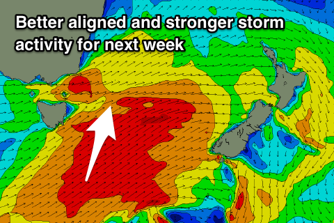
We'll see the storms take a more angled south-west to north-east track through our swell window through the middle to end of next week, with a better sized S'ly groundswell on the cards for Wednesday morning to 3-5ft, with a possible large long-period swell for Thursday as storm-force winds are projected past us.
We'll have a closer look at this Monday. Have a great weekend!

