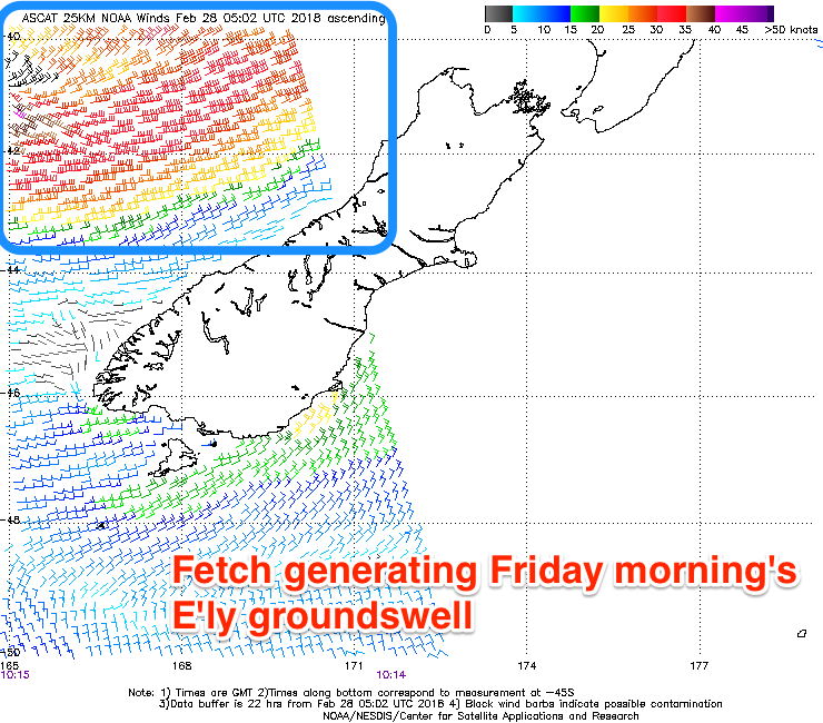
Friday the pick
Eastern Tasmania Surf Forecast by Craig Brokensha (issued Wednesday 28th February)
Best Days:
Recap
Super fun waves again yesterday morning with a clean S/SE groundswell, easing back into this morning.
A small mix of N/NE windswell and E/NE swell have kept small 1-2ft waves hitting the coast today.
Today’s Forecaster Notes are brought to you by Rip Curl
This week and weekend (Mar 1 - 4)
We've got some fun E'ly swell due to end the week, generated by a deepening Tasman Low off the New Zealand west coast.
A fetch of strong to gale-force E'ly winds was picked up by satellite this morning, and a good E'ly groundswell pulse is due to arrive later tomorrow, peaking Friday morning.
Open beaches should reach 2-3ft by dark tomorrow, and come in at a good 3ft on Friday morning before easing into the afternoon.
Also in the mix will be a small building S'ly windswell tomorrow with a surface trough drifting in from the west, aiming a fetch of S/SW winds up past us.
 South magnets should increase to 2-3ft later in the day with a fresh SW tending S/SE wind.
The swell will ease back through Friday from 1-2ft max, with the E'ly groundswell the pick of the bunch. A morning SW wind is expected to swing SE, keeping southern corners fun most of the day.
Into the weekend the E'ly swell will fade away, but the trough responsible for tomorrow's windswell will produce a small weak S/SE fetch in our south-east swell window Friday.
A small SE swell is due from this fetch, possibly building later Saturday but coming in at 2ft Sunday morning.
Conditions look good each morning with offshore winds, N'ly Saturday afternoon and S/SE Sunday.
Longer term the outlook is promising with a strong stationary ridge likely to develop in the southern Tasman Sea and across New Zealand with tropical depressions squeezing its northern flank. Building levels of E'ly swell may be seen from later next week, but more on this Friday.

