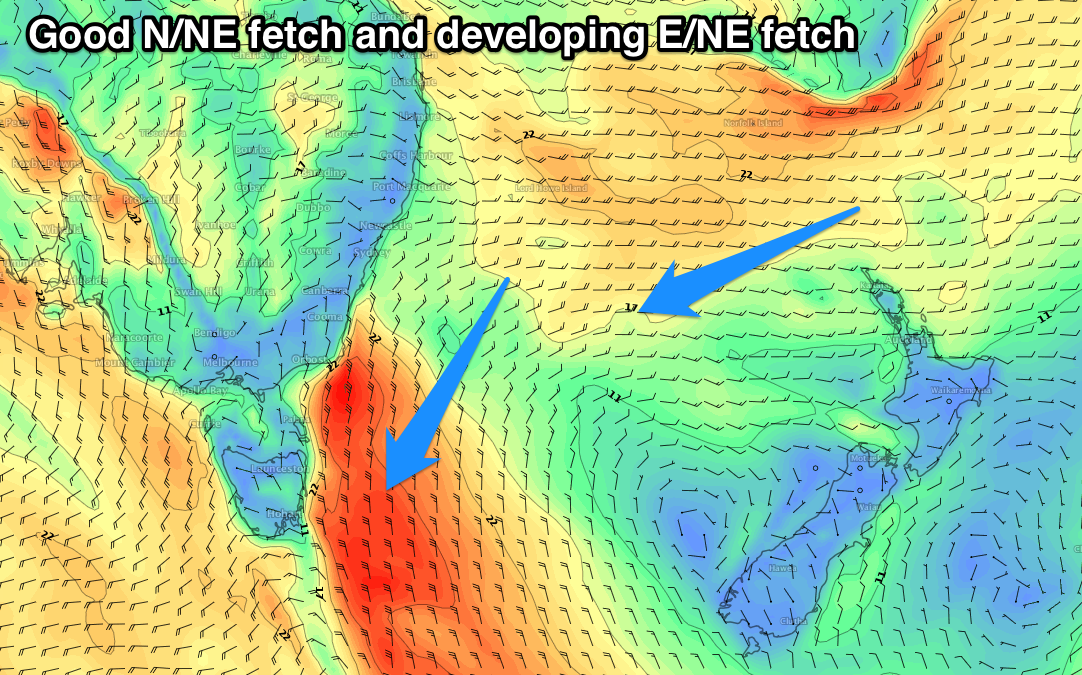
Developing N/NE windswell followed by E/NE groundswell
Eastern Tasmania Surf Forecast by Craig Brokensha (issued Wednesday 24th January)
Best Days: Northern corners Sunday, Monday, Thursday onwards next week
Recap
Tiny N/NE windswell yesterday to 1-1.5ft, even smaller today.
Today’s Forecaster Notes are brought to you by Rip Curl
This week and next (Jan 23 - Feb 2)
The end of the week doesn't hold much hope of any getting in a decent surf, tiny levels of NE windswell will start to develop from tomorrow and maybe reach 1-2ft or so through Friday though with early offshores ahead of a weak SE change.
Moving into the weekend though we'll see a strong high established in the Tasman Sea being squeezed on its western flank by a deepening inland surface trough across Victoria.
This will see a great fetch of N/NE winds strengthening through our north-east swell window over the weekend, reaching a peak in intensity Sunday evening.
 We'll see a slow increase in swell Saturday from 1-2ft to 2-3ft later in the day, increasing further towards 3-5ft later Sunday but with strong N/NE winds.
We're looking at a peak in N/NE windswell Monday morning to 4-5ft or so as winds swing from the W to S/SE as the trough moves east across us.
Some small S/SE windswell is likely to fill in Tuesday, but of greater importance is an additional pulse of E/NE groundswell later in the week.
While the high will be squeezed from the west generating the N/NE windswell, a deepening tropical low on its northern flank looks to drift towards New Zealand, aiming a fetch fetch of strong to gale-force E/NE winds in our eastern swell window.
A strong E/NE groundswell would be expected to arrive Thursday and peak Friday in the 4-5ft range at this stage, but more on this Friday.

