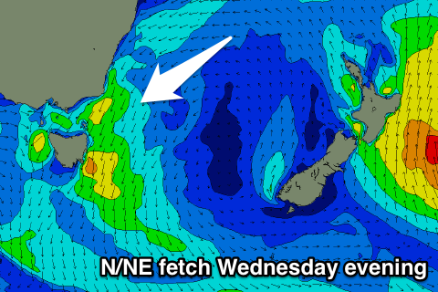
Mid-week N/NE windswell
Eastern Tasmania Surf Forecast by Craig Brokensha (issued Tuesday 26th December)
Best Days: Thursday
Recap
Tiny surf over the weekend and yesterday, similar into this morning.
Today’s Forecaster Notes are brought to you by Rip Curl
This weekend and next week (Dec 23 - 29)
This forecast period revolves around the N/NE windswell due over the coming days.
Currently we're seeing a high pressure system move into the Tasman Sea and we'll see the system stall as a surface trough approaching from the west squeezes its western flank.
 This will produce a strengthening fetch of N/NE winds during tomorrow, but more so into the evening, with the most size expected Thursday morning.
A small weak 1ft to maybe 2ft wave is due tomorrow morning, building later in the day towards 2ft+, with Thursday morning expected to come in around 3ft at north-east facing beaches.
Winds will be average and freshening from the N/NE tomorrow, N/NW Thursday and swinging more W/NW later in the day ahead of a S/SE change around dark.
Friday looks a little dicey with onshore winds possibly lingering after Thursday evening's change with a tiny fading N/NE windswell from 1-1.5ft.
Longer term there's nothing significant at all on the cards, but more on this tomorrow.

