Small flukey south swells
Eastern Tasmania Surf Forecast by Craig Brokensha (issued Wednesday 20th December)
Best Days: No good days
Recap
Just a trickle of tiny NE swell the last couple of days, cleanest this morning and fading under a stiff offshore.
Today’s Forecaster Notes are brought to you by Rip Curl
This week and weekend (Dec 21 - 24)
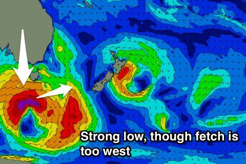
What ever tiny N/NE swell was seen this morning will be gone tomorrow, and a severe low that's currently south-west of the state is dipping south-east while generating an unfavourable (though strong) westerly fetch.
This isn't expected to generate any significant swell at all, with only maybe 1-2ft sets at south magnets tomorrow afternoon, fading into Friday.
 A secondary strong polar front moving through Clifton's swell window may generate a similar sized and flukey S'ly swell for later Friday and Saturday morning, though again not over 1-2ft max.
Conditions will be favourable for south magnets though with afternoon N/NW winds.
A weak S'ly change on Monday will kick up a poor small and weak S'ly windswell though again only to 1-2ft and with onshore winds.
The longer term outlook is a little more promising with a good run of N/NE windswell on the cards mid-late next week, but more on this Friday.

