Good mix of improving swells tomorrow, OK Sunday, clean and easing Monday
Eastern Tasmania Surf Forecast by Craig Brokensha (issued Friday 27th October)
Best Days: Saturday, Sunday morning, Monday
Recap
Tiny surf yesterday and this morning, but later today we should see a slight kick in N/NE windswell with strengthening N/NE winds.
This weekend and next week (Oct 28 – Nov 3)
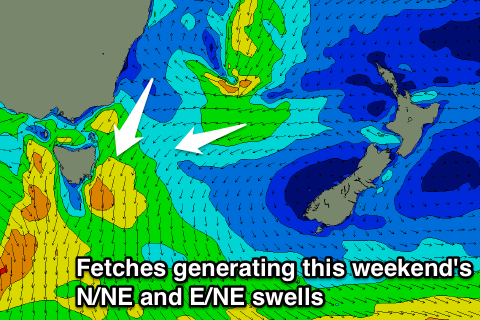
 We've got two separate swells due over the weekend, a N/NE windswell for tomorrow morning and more pro-longed E/NE swell event.
Firstly the N/NE windswell will be generated by a fetch of strengthening N/NE winds down out coast this evening and early tomorrow as a strong mid-latitude front pushing in from the west, squeezes a strong high moving east through the southern Tasman Sea.
We're looking at good surf to 3ft or so across north-east facing beaches tomorrow morning, if not for the odd bigger one at dawn, and a morning N/NW breeze will tend more offshore from the W/NW into the afternoon and evening.
Also in the mix will be some fun E/NE swell from the southern flank of a weak Tasman Low that's currently sitting east of Sydney.
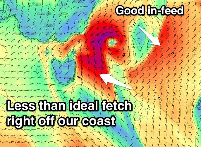
Currently a good fetch of E'ly winds are being aimed on the edge of our swell window, but we'll see the low drift east-southeast through this evening, aiming the fetch more favourable towards us through tomorrow morning, before weakening into the evening and early Sunday.
 This will help make a fun prolonged E/NE swell event, filling in through tomorrow and building to 2-3ft into the afternoon, holding Sunday and then easing back from 2ft+ Monday morning.
Monday morning will also see some additional N/NE windswell, but not above the existing E/NE swell, and our models are incorrectly combining the two, showing more size early Monday than there really is.
Coming back to the local winds and early Sunday a N/NW'ly is expected, strengthening from the N'th through the day, while offshore W/NW tending W/SW winds are expected on Monday.
The E/NE swell will be all but gone on Tuesday, but we're set to see another Tasman Low form in the Tasman Sea, though with more strength than the current system and most so off our coast.
This low is forecast to generate gale-force S/SE winds directly east of us into Tuesday afternoon and evening, before hugging the far southern NSW coast.
Because of the close proximity of the low to us, the swell from this system is super tricky to forecast this far out. If the low sits and further north the size will be much smaller, and vice versa. Therefore check back Monday for an update on how this system is tracking.


Comments
Morning swellnet , can you please advise if the forecaster notes will be updated for east coast tassie this week ?
Craig is away this week, I’ll see if I can find some time to update the notes today.
cheers ben just doing a trip down there from friday - tuesday and wanted to see if i will get some waves
Still no update ?
Sorry mate, just haven’t had time. Will try to get one up tomorrow.
Hey Ben can appreciate lack of time with Craig away - the forecasted well today was pretty underwhelming. If you find a spare bit of time, I'd appreciate it heaps if you could please just provide a quick update if it's delayed or what's going on with it ? How big do you reckon it'll be tomorrow morning ?
Good luck with the extra work,
Cheers