Fading SE swell, weak S'ly windswells
Eastern Tasmania Surf Forecast by Craig Brokensha (issued Friday 18th August)
Best Days: Tuesday morning
Recap
A solid S'ly swell filled in Saturday but winds weren't ideal for locations that were picking up the most size.
Sunday was better with 3-4ft sets and offshore winds, while today's reinforcing SE swell has come in a bit better than expected with 3ft sets continuing across open beaches.
This week and weekend (Aug 22 - 27)
Today's SE swell was generated by a good fetch of SE winds off New Zealand's South Island, but this fetch has since disappeared and we should see easing surf from the 1-2ft range tomorrow morning with offshore W/NW winds.
There's nothing significant expected for the rest of the week besides a poor S'ly windswell Thursday afternoon.
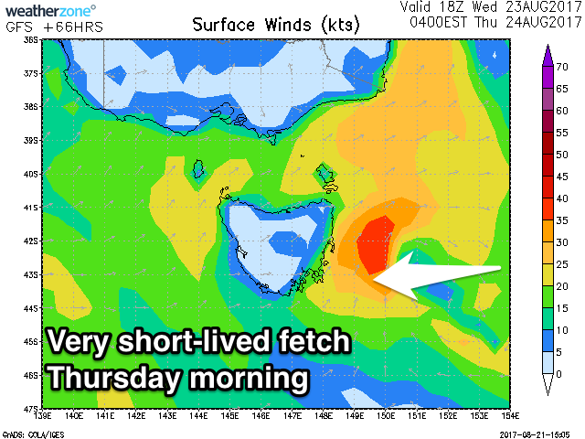
 This will be generated as a small surface trough moving east deepens right off our coast. We'll see a short-lived fetch of strong to gale-force S/SW winds early Thursday moving off to the east through the day.
We may see 1-2ft of S'ly windswell developing across south facing beaches but with SW winds, tiny Friday and back to W/NW offshores.
Into the weekend, a S'ly change Saturday may generate another pulse of S'ly windswell for Saturday afternoon to 2ft+ across south facing beaches but with S'ly winds. Come Sunday the swell will be cleaner but fading from 1ft.
Longer term, a strong polar frontal progression will generate some SW groundswell that may spread back into our south magnets Sunday afternoon and Monday morning, but only to 2ft.
We'll have a closer look at this Wednesday.

