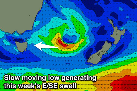
Fun E/SE swell this week
Eastern Tasmania Surf Forecast by Craig Brokensha (issued Monday 20th March)
Best Days: Protected southern corners Thursday morning, Friday and Saturday mornings
Recap
Small waves across magnets over the weekend, cleanest each morning. Today a touch more size was seen with a N/NE swell but conditions were a little average before a weak S'ly change hit, favouring southern corners.
This week and weekend (Mar 21 - 26)
Today's NE swell should ease back through tomorrow from a small 2ft at magnets, and a surface trough drifting in from the west is expected to deepen off our coast.
This will bring increasing onshore E/SE winds Tuesday (possibly variable early), fresh and gusty from the SE Wednesday.
 The trough will deepen into a low tomorrow evening, with a strengthening fetch of E/SE winds being aimed through our eastern swell window, persisting through the end of the week as the low slowly pushes east towards New Zealand.
This will generate moderate levels of E/SE swell, building Wednesday and persisting through Thursday and Friday before easing off slowly over the weekend.
Open beaches should see sets building to 3ft Wednesday but with those onshore winds, kicking to 3-4ft through Thursday and holding this size Friday and early Saturday.
S/SE winds might linger Thursday morning, but Friday and Saturday mornings are looking clean and fun.
Longer term a vigorous mid-latitude frontal progression approaching from the west early next week will squeeze a strong high in the Tasman Sea, generating a solid NE swell event, but more on this Wednesday.

