N/NE windswell for Sunday/Monday, S'ly swell mid-late week
Eastern Tasmania Surf Forecast by Craig Brokensha (issued Friday 7th October)
Best Days: Later Sunday northern corners, early Monday, Wednesday south magnets
Recap
Generally flat yesterday but there was the odd small line across swell magnets through the day, back to flatness today.
This weekend and next week (Oct 8 - 14)
Tomorrow will be tiny but some decent N/NE windswell is now due to develop through Sunday afternoon and evening as a vigorous low to our west squeezes a strong high in the Tasman Sea.
 A fetch of N'ly gales will develop down the coast, with the windswell expected to build to 3-4ft at north-east facing beaches into the afternoon as winds tend N/NW.
The fetch will move offshore overnight resulting in easing clean 2-3ft sets at dawn Monday, tiny into the afternoon under W/NW winds.
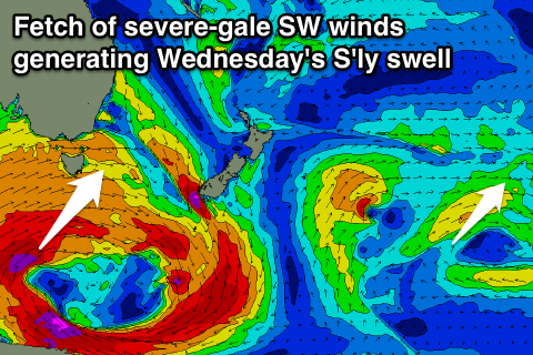
As talked about last update, we should see some S'ly swell into the end of the week as the vigorous low to our west drifts further east and into our swell window.
We're not expected to see any size until Wednesday, when a swell from a fetch of SW gales projecting north-east through our swell window moves in.
We should see south facing beaches offering 3ft sets with W/SW winds.
On the backside of the low we may see a better aligned S/SW fetch, but the models are still a little divergent, so more on this Monday. Have a great weekend!

