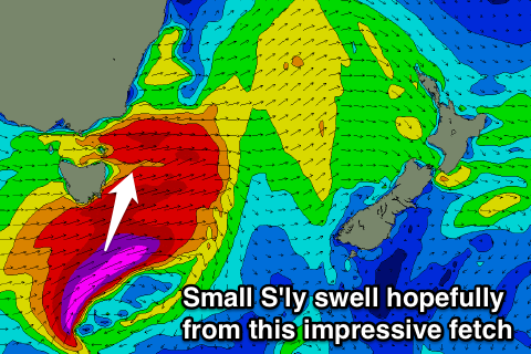
Flukey small south swell tomorrow
Eastern Tasmania Surf Forecast by Craig Brokensha (issued Wednesday 5th October)
Best Days: No good days, south magnets midday tomorrow if you're in the region
Recap
Tiny waves yesterday, flat into today.
This week and weekend (Oct 6 - 9)
Tomorrow's possible small increase in S'ly swell is still on the cards but again, 2ft sets max are due across south swell magnets if anything.
 The peak has been shifted more towards the middle of the day, and it will be generated by a vigorous mid-latitude low pushing across us this afternoon and evening, generating a fetch of severe-gale to storm-force W/SW winds through our swell window.
Gusty W/NW winds will keep these south facing beaches cleanish, with tiny surf then due into Friday.
The only other source of swell for the rest of the period is a possible small N/NE windswell later Sunday, fading Monday.
This will be generated by a fetch of strengthening N'ly winds down the coast Sunday from a deepening low south-west of the state.
Average winds are due when the swell builds possibly to 2ft late Sunday, fading rapidly Sunday with offshores. We'll have another look at this Friday to see if the fetch lingers longer Monday for more size.
Longer term we could see a good run of S'ly swell from the middle of next week, but more on this Friday.

