Good mix of E/NE and NE swells for the weekend

Eastern Tasmania Surf Forecast by Craig Brokensha (issued Friday 23rd September)
Best Days: Early Saturday, Sunday
Recap
Not the best day yesterday with onshore S/SE winds and the swell dipping away a little more than expected.
Today though a new E/NE swell was on the build with clean conditions early and 2-3ft sets, but a further increase has since been seen with onshore winds.
This weekend and next week (Sep 24 - 30)
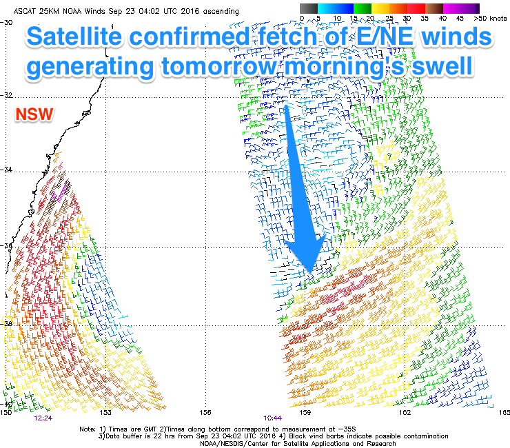
Today's building E/NE swell is due to another intense low moving off east into the Tasman Sea, directing a fetch of strong to gale-force E/NE winds towards us.
The low reached a peak in intensity last night and is now weakening while drifting slowly east towards New Zealand.
 A peak in size is expected overnight, dropping back from 3-4ft or so tomorrow morning, smaller through Sunday.
Some new NE windswell will build later Saturday though and into Sunday morning from a strengthening fetch of NE winds off the coast.
This should see 2-3ft sets continuing into Sunday morning, easing into the afternoon, with 1-1.5ft leftovers Monday.
Conditions will be best early tomorrow before a gusty NE'ly develops with a light N/NW breeze. Sunday should then see offshore W/NW winds through the morning, tending more W/SW through the afternoon.
Into the start of next week the surf will remain small to tiny. A slight increase in inconsistent E/NE swell may be seen Tuesday and Wednesday from a weak fetch of E/NE winds exiting Cook Strait Sunday but we'll review this Monday.
Otherwise some N/NE windswell may be seen Thursday but this depends of a strong low moving in from the west. More on this Monday. Have a great weekend!