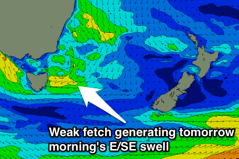
Rapidly fading easterly windswell tomorrow
Eastern Tasmania Surf Forecast by Craig Brokensha (issued Wednesday 14th September)
Best Days: Early Thursday
Recap
Poor conditions the last few days with developing onshore winds and building windswell into today from a deepening low to our west.
This week (Sep 13 - 16)
The low that's currently to our west will start moving south-east through this evening and this will result a fetch of strong E/SE winds aimed into us overnight drifting south out of our swell window early tomorrow.
 The return S'ly fetch isn't expected to be anywhere near as strong now with a weak burst later tomorrow afternoon.
So we're now expected to see easing E/SE swell from 2ft to possibly 3ft max at dawn, biggest across the southern half of the coast, and then maybe a tiny late afternoon kick in S'ly swell, easing back from 1-1.5ft Friday.
Conditions will be good tomorrow but get out for the dawn session for the most size.
Into the weekend there's nothing significant at all due with some possible N/NE windswell into early next week. Beyond this we may see another low forming later next week, but more on this Friday.

