Local swells building into next weekend
Eastern Tasmania Surf Forecast by Guy Dixon (issued Monday 15th December)
Best Days: Friday morning, Saturday morning and Sunday
Recap:
The swell remained pretty much non-existent throughout the weekend, with only hints of a tiny southerly swell at the most exposed magnets on Sunday. The surf would’ve maxed out in the 0.5-1ft range, fortunately winds remained offshore all day, unlike Saturday which saw an afternoon seabreeze develop.
This week (Tuesday 16th - Friday 18th):
The early stages of this week are looking fairly slow, with the local swell windows being the only source of significant swell.
A high pressure ridge is looking to reside over southern parts of the Tasman sea during the coming days, steering a small and light east/northeasterly fetch over northeastern Tasmania.
Tiny amounts of northeasterly energy are set to fill in across the open beaches, building marginally each day. Tuesday is looking at 1ft peaks under a light, but persistent east/northeasterly breeze, building to the 1-2ft range on Wednesday under a light northeasterly breeze (possible light variable breezes early). The surf should hold at a similar size on Thursday, with light northwesterly breezes preceding a northeasterly seabreeze.
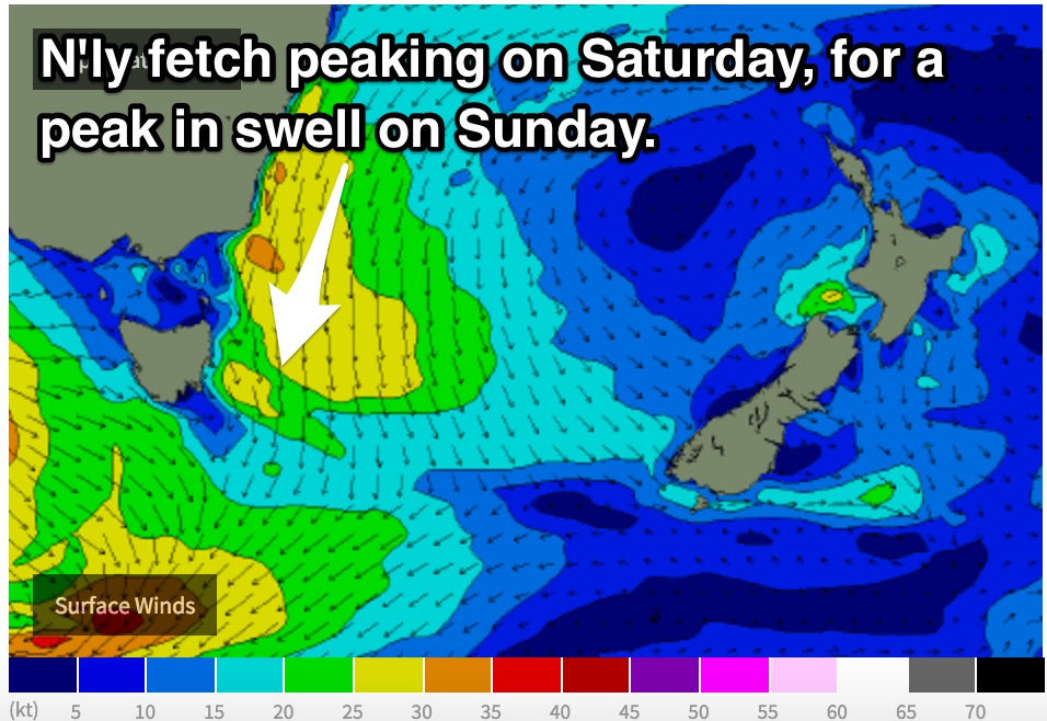
A larger scale north/northeasterly fetch is expected to set up off the far South Coast of NSW, extending across eastern parts of Bass Strait on Thursday evening providing a pulse of northeasterly swell for the open beaches on Friday.
We should see the surf build to the 2ft+ range on Friday, with the outside change of the odd bigger set. Winds are expected to prevail from the north, light in the morning, tending northeasterly and increasing slightly in the afternoon.
This fetch looks to linger off the NSW South Coast until at least late Saturday or into the early hours of Sunday morning, whilst also intensifying and becoming broader.
This weekend (Saturday 19th - Sunday 20th):
 Saturday is expected to wake to 2-3ft options out of the northeast, building to the 3ft range by the afternoon.
The surf is then expected to build further to the 3-4ft range across the exposed beaches on Sunday morning, easing slowly thereafter.
Models are struggling to agree with the wind outlook (from about Friday onwards) as the pressure pattern slackens. Winds should be light each morning, increasing from the northeast on Saturday afternoon and northwest on Sunday afternoon.
In either situation there should be good options on offer each morning, with Sunday looking like the pick of the bunch. No doubt, models will come into agreement and the next forecast will be able to shed more light on the up coming weekend.

