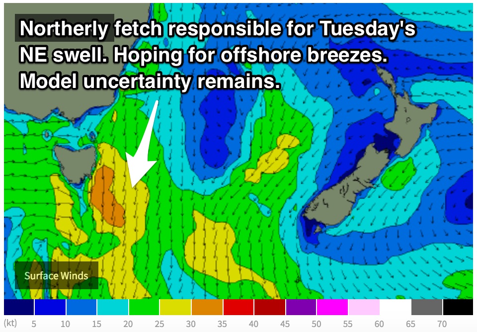
Fingers crossed for offshore breezes on Tuesday morning
Eastern Tasmania Surf Forecast by Guy Dixon (issued Friday 27th November)
Best Days: Hopeful for offshore breezes on Tuesday morning.
Recap:
Thursday offered small but workable peaks in the 2ft range at open beaches under an offshore breeze which persisted virtually all day. It was only modest, but open beaches did okay, smaller elsewhere. This afternoon has been a lot smaller, with only 0.5-1ft remnants of yesterday’s swell. Yes, it’s been clean, but undersized.
This weekend (Saturday 28th - Sunday 29th):
The swell outlook over the coming days is looking fairly small, with only subtle pulses at exposed swell magnets.
The best chance of finding a wave on Saturday will be at the most exposed south swell magnets where a small an inconsistent southerly swell in the 1ft, occasionally 2ft range will fill in. The breezes which have been generating this swell today have been local in nature and west/southwesterly so the alignment is far from ideal.
As a result, only the most exposed magnets can expect a wave, near flat elsewhere.
This swell will fade to the 0.5-1ft range on Sunday, however open beaches are expected to gain a small amount of northeasterly energy.
A northerly fetch off the coast of NSW and eastern Bass Strait during Saturday evening and Sunday morning should provide peaks in the 1ft range for open beaches.
Westerly breezes will keep conditions clean throughout Saturday morning, potentially tending light northeasterly in the afternoon. Conditions are expected to be light/calm/variable on Sunday morning, potentially tending light northeasterly at times.
Next week (Monday 30th onward):
 A northerly airflow is likely to increase along the NSW coast, Bass Strait and the east coast of Tasmania on Monday afternoon, whipping up a short range northeasterly windswell to the 2ft range on dark. Local breezes will have an impact on the quality of the surf, leading to bumpy conditions.
Tuesday morning will see the bulk of this swell, with open beaches building to the 2-3ft range. Some models suggest a period of northwesterly breezes in the morning, while others have the airflow persisting from the north all morning.
We are hoping for the initial scenario for clean options, as this could potentially be the only opportunity for a semi-decent wave. Models are divergent at the moment, we will just have to have a monitor the situation in Monday’s notes, but keep it free in case.
The surf will then fade into the afternoon across all coasts, before a front and associated low over over the region on Wednesday.
Gusty west/southwesterly breezes are expected to generate a poorly aligned windswell for the south magnets on Wednesday, but only to around 1ft.
There are very few other indications of significant swell in the near future, however we may see the effects of a tropical depression in the south pacific by the weekend. In this scenario, open beaches have the potential to pick up very inconsistent 2-3ft surf if everything goes to plan.

