Finally, a decent swell on the cards for Tuesday

Eastern Tasmania Surf Forecast by Guy Dixon (issued Wednesday 21st October)
Best Days: Tuesday
Recap:
Conditions were beautifully clean and glassy on Tuesday morning under a light north/northwesterly breeze, but the surf was the one ingredient that was missing. A 0.5ft swell from the south was described by the morning reporter as a ‘ripple’.
In contrast, the surf was a turbulent mess under a stiff south/southeasterly breeze this morning. Choppy short range swell has increased as fresh southerly winds continue along the coast, but the quality is poor.
This week (Thursday 22nd - Friday 23rd):
Today’s short range southerly swell will fade throughout Thursday with only small and subtle hints of residual northeasterly energy in the water. Size wise, there isn’t likely to be anything significant. We are expecting mere dribbles in the 0.5ft range and it’s looking to stay like that for a few days.
This weekend (Saturday 24th - Sunday 25th):
Apart from background southerly energy generated by weak, poorly aligned frontal activity, the next best chance of surf comes on Sunday morning.
Trailing fetches off the back of a frontal progression have the potential to generate a small southerly groundswell which should provide inconsistent 1-2ft peaks at south facing beaches. These locations will also be the cleanest as a gusty northerly breeze dominates along the coast for much of the day.
 Next week (Monday 26th onward):
Next week is looking more promising for swell.
A gusty southerly change will move up the coast first thing on Monday morning leading to a strong increase in short range southerly swell. South facing beaches should build into the 3-5ft range late, but the quality is likely to be poor under fresh southerly breezes.
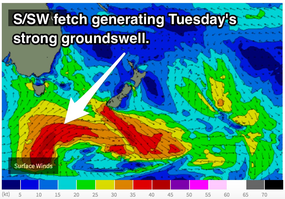
There is also a chance we may see the first signs of a strong southerly groundswell generated by a strong polar frontal progression steering south/southwesterly severe gales, but this will likely be clouded by the short range energy.
Tuesday is looking like the day of most interest as the bulk of the southerly groundswell fills in. The surf is expected be in the 4-6ft range in the morning, easing in the afternoon.
Light southeasterly breezes are on the cards on Tuesday morning, so the impacts shouldn’t be overly dramatic, but if need be, protected southern corners should offer good protection from the breeze. Plenty of energy should still filter into these protected corners with swell periods potentially reching into the 16 second range. We just hope there isn't too much scarring from southerly breezes the day before.
The surf should ease in the coming days with tentative indications of more long range groundswell for Friday off another trailing fetch.
Fingers crossed.