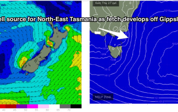
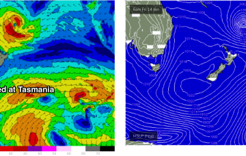
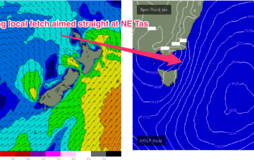
First from the western flank of the high as the tightened pressure gradient sees N’ly winds freshening off the Gippsland coast and aimed well at NE Tas.
Primary tabs
New high pressure slips into the Tasman Thursday and immediately has the pressure gradient on the western flank tightened by an interior trough system. That sees a fast developing N to NE fetch off the Far South Coast and Gippsland build NE windswell off the NE Coast of Tasmania during Thurs.
The blocking pattern remains in place for most of next week. First, the initial high maintains position just East of Tasmania with weak pressure gradients and only light N to NE winds in the swell window- not enough to generate any more than a foot or so of weak windswell.
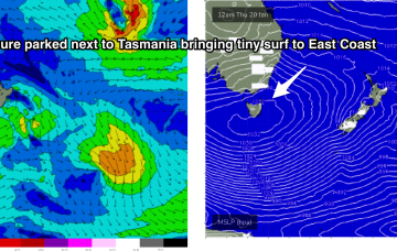
Unfortunately the blocking pattern is in a poor position for East Coast Tasmania with both swell windows effectively shut down as high pressure slowly moves to sidle up next to Tasmania.
With high pressure parking itself beside Tasmania for most of this week we’re expecting a period of tiny surf to become established through Thurs into the weekend and early next week, with swell sources effectively blocked by the large high .
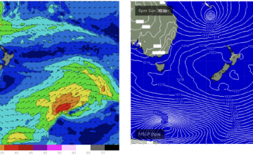
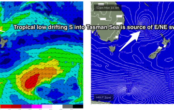
The slowed movement and enlargement of the wind field as it approaches the North Island are on track to deliver more powerful long period E-E/NE swell, not ideally aimed for Tasmania but with enough strength to deliver some 3-4ft sets through Mon and Tues.
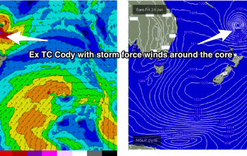
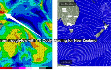
In the tropics TC Cody is drifting south through the South Pacific window , spraying the NSW/QLD coast with swell. The fetch is not well aimed for NETas but radial spread from the source should see some inconsistent 3-4ft sets through Mon, into Tues with winds much better on Mon.
The GFS scenario sees NE winds developing in the swell window Thurs with surf building into the 3ft range. A much bigger NE swell builds Fri into the 5-6ft range. With fresh NE winds.
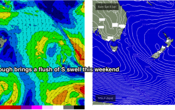
The rest of next week looks uneventful for the East Coast. A weak trough brings a slight bump in S swell Tues but its short period, weak stuff and unlikely to exceed 1-2ft.
This fetch gets super-charged off Bass Strait and adjacent to the east coast of Tasmania by an interior trough, with E to E/NE gales expected to develop off the Gippsland coast later tomorrow (see below).

